Trump and Confederate flags fly together forever. Minneola, Kansas. June 2020.
I left maskless Meade, with its coded "Situation," and just up the road a bit, passed through Minneola.
On this road trip into the Midwest, it has been so disconcerting to see how people twin Trump with the traitorous Confederate States of America, founded to protect the practice of enslaving women, men, and children.
It is raw racism, unmasked and unashamed.
I can get that this is part of the Trump brand.
But how does one reconcile the pairing of the United States flag with the Confederate flag, as if they were equal? Isn't this action on the level of burning the American (that is, the United States of America) flag?
Crossing the threshold of Meade's Thriftway grocery store thrust me back to pre-COVID times.
No one wore a mask.
There were no plexiglass shields between the cashier and the customers.
Checking into the motel - no masks.
Stepping into the smoke-sodden air of a Meade convenience store - no masks. Oh, I did witness one masked fellow entering the attached restaurant. An out-of-towner like me?
It was all a bit of a culture shock, actually.
On my second day in Meade, I did observe three instances, perhaps, of mask-wearing.
Gosh, it would only take one, asymptomatic, drive-through tourist to set off a viral spark in sleepy ol' Meade.
In the unlikely case I'm infected-but-asymptomatic, it ain't gonna be me to light that spark.
Stone building, Highway 54, between Vaughn and Santa Rosa, New Mexico. June 2020.
June 2020
Back here, I knew that my first stop after leaving Tucson would be in Las Cruces, New Mexico. But I didn't know where I'd head from there.
Then an important day for one of my descendants popped up, and that event determined my second destination: Central Missouri.
COVID-19 had an opinion about how I was to get there.
Should I take the route I yearned to take - Highway 54 through New Mexico? Revisit past scenic and cultural touchstones, perhaps for the last time, as I have no idea when I might - if ever - return to the Southwest? But knowing it would be a challenge to find a spot to overnight in Chez P because of state and national park closures, and the dearth of rest areas on this route (which weren't open, anyway)?
Or should I drop down to El Paso, then shoot east through laissez-faire Texas and up through Oklahoma, interstates all the way, hopeful of open rest areas and truck stops where I could overnight in Chez P instead of a motel?
Romantic nostalgia won out over clinical practicality. Highway 54 it was to be.
The first time I traveled on Highway 54 in New Mexico was in 8888. The last time was in 2013.
Things have changed. Some then and now photos below.
Carrizozo junction
The junction of Highways 54 and 380 in Carrizozo (near Valley of Fires), at my traditional pit stop, where I went to the bathroom and bought a banana.
In 2013, the c-store/gas station was an Allsup's. Next door sat an old building, C&A Stromberg Trading Post. That giant square of color against the New Mexican sky always cheered me.
Stromberg's at junction of Highways 54 and 380, Carrizozo, New Mexico. September 2013.
In 2020, Stromberg's is gone. The refurbished c-store expanded into the space Stromberg's left behind.
Junction of Highways 54 and 380, Carrizozo, New Mexico. June 2020.
Eyes of Duran
I saw the eyes for the first time in 2013.
Eyes of Duran, Highway 54, New Mexico. September 2013.
Here's what they looked like in 2017.
Eyes of Duran, Highway 54, New Mexico. July 2017.
And in June 2020.
Eyes of Duran, Highway 54, New Mexico. June 2020.
You can read a tragic history of the people who used to own this building in this City of Dust story.
The stone building
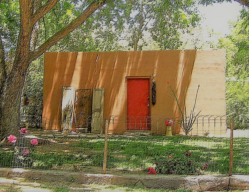
This stone building breathed both desolation and life to me each time I met it on Highway 54, between Vaughn and Santa Rosa.
Here it is in 2013, like a painting.
Stone building, Highway 54, between Vaughn and Santa Rosa, New Mexico. September 2013.
And in June 2020.
Stone building, Highway 54, between Vaughn and Santa Rosa, New Mexico. June 2020.
The eyes of Duran attracted me in 2012 and 2013, when I lived in Alamogordo:
Eyes of Duran, New Mexico. 2013.
On my way back to El Paso from my 2017 Missouri Flash Trip, along Highway 54, I felt eager to slap my own on them again. Here they are, four years after ours first met:
Ohhhhhhhhhhh, how nice it was to re-ride Highway 54 from Tucumcari to El Paso. I drove this path so many times when I lived in Alamogordo in 2012-2013.
Come with me. We'll listen to oh-so-good music on the way.
Here's Highway 54 mile marker 165, between Corona and Carrizozo, accompanied first by Connie G in Let the Good Times Roll, followed by Boozoo Chavis with Johnnie Billy Goat:
Here's Highway 54 mile marker 155, between Corona and Carrizozo, as we're a tiny audience to the renowned Canray Fontenot's quiet song, La Tabla Ronde:
I had to pull over to the side of the road between Carrizozo and Tularosa to take in the beauty of a train against the mountains and a splendid sky, while being serenaded by the now-deceased Buckwheat Zydeco, with Tee Nah Nah:
Close to home here, between Alamogordo and El Paso, accompanied by the Balfa Brothers performing La Danse de Mardi Gras:
As I drove north on Highway 54 for the last time in my year of New Mexico, I went through the same towns I passed through so many times in the past year:
As usual, I stopped at the Allsup's in Carrizozo at the intersection of Highways 54 and 380. In exchange for the use of the facilities, I bought my 25-cent banana. Kudos to c-stores that sell fresh fruit!
Antique store next to Allsup's, Carrizozo, New Mexico
As I whipped by Duran, I blinked acknowledgement at the green eyes.
Duran, New Mexico
I made another common stop for another bio break at the station in Corona, kind of in the middle of nowhere (but isn't so much of New Mexico in the middle of nowhere?), where I bought my customary can of Diet Coke for 85 cents. (Pity, no fresh fruit here. But the proprietors are as friendly as those in Carrizozo.)
Corona, New Mexico
Some time before Vaughn, I felt wistful at the sight and sound of a southbound train. New Mexico is so much about trains.
Highway 54 between Corona and Vaughn, New Mexico
And how could I not turn around and appreciate this derelict on the plain?
Highway 54 between Vaughn and Santa Rosa, New Mexico
Highway 54 between Vaughn and Santa Rosa, New Mexico
Highway 54 between Vaughn and Santa Rosa, New Mexico
Highway 54 between Vaughn and Santa Rosa, New Mexico
The waving grass, the wind, prompted me to capture the moving version.
It still gives me pleasure to think I can get onto Highway 54 in Jefferson City, Missouri, and follow it through New Mexico, through Alamogordo - my home for one year - to El Paso, Texas.
I have passed this building so many times in my lopes up and around New Mexico this year. These eyes. One of the most striking features of the village of Duran.
Yet another reminder of how we sometimes pass by a spot in the universe that practically shimmers with the ectoplasmic echoes of personal histories - dramas that were so cataclysmic for those involved - but of which we are unaware.
Whereas there's no doubt Alamogordo is in the high desert, just 13 miles away is shady, tree-lined Tularosa.
Tularosa, New Mexico
I'm told that Alamogordo would be just as oasis-like as Tularosa, but for the fact it did away with its acequia system long ago, while Tularosa still has (some of) its system.
True or false or more complicated? Don't know.
Tularosa, New Mexico
If you swing through Tularosa on Highways 54 and 70 without stopping, you see a promise of its seductions - like a bit of ankle showing in Victorian English times - when you pass by San Francis de Paula's lush campus.
Tularosa, New Mexico
You wouldn't guess at the loveliness of the residential houses and yards behind the front lines of shops.
There's a trade-off. With the haven of mature trees, the nearby Sacramento Mountains recede into the background, whereas in Alamogordo they are as equal residents of the city.
About the name, Tularosa. Its origin has nothing to do with roses, but the inhabitants have surrendered to the inevitable assumption and now calls itself the city of roses. Indeed, roses of all colors run promiscuously throughout the village.
An acquaintance of mine relocated here from Santa Fe for some very practical reasons: Tularosa shares some of the same charms as Santa Fe - traditional New Mexican architecture, proximity to mountains, and an arts community (albeit small) - while being far more economical to live because of lower real estate prices and energy costs. Being in southwestern New Mexico, Tularosa's winters are milder than in Santa Fe or Taos. I would add that one will find a much narrower income disparity amongst Tularosa residents than amongst Santa Fe or Taos residents.